This is a fun little project on the study of place names in the Low Countries.
I downloaded all inhabited places in the Netherlands, Belgium, France and Germany from geonames.org to study the distribution of place name suffixes. Coastline and border data are from the R-package “rworldmapxtra”; lake data are from the “10m WISE large rivers and large lakes” data set of the European Environment Agency.
Some of these suffixes show very interesting spatial patterns. Such as the “-lo” and “-loo” suffixes (see figure below), indicative of open deciduous forest. I tend to associate this suffix very much with the East of the Netherlands (Hengelo, Almelo, Dwingeloo), but it turns out to be surprisingly common in Belgium as well!

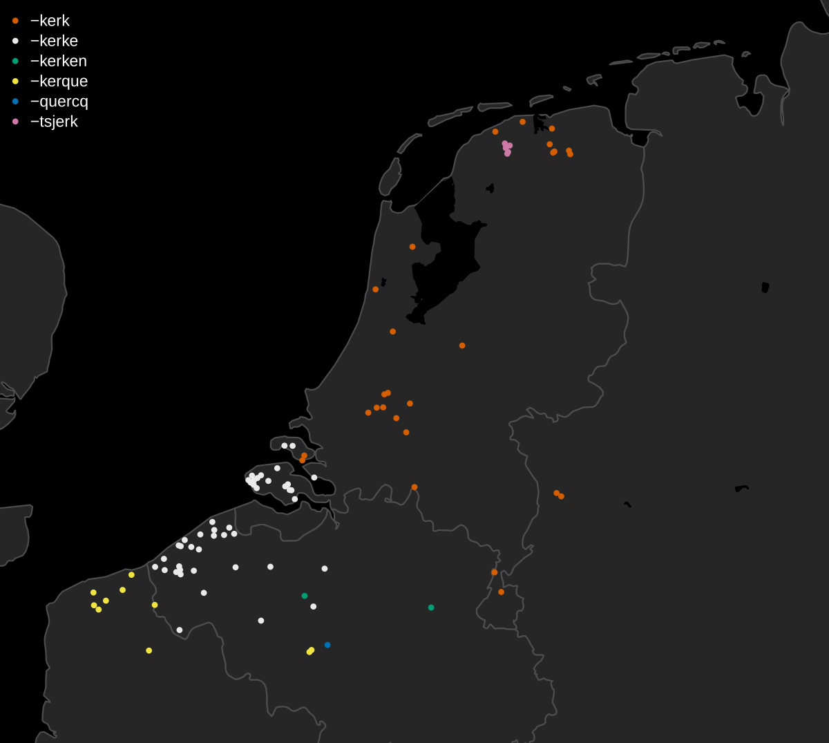
I grouped spelling variants of the same suffix together. One of the suffixes with the most variants is “-kerk” [church] , which occurs in six different forms (-kerk, -kerke, -kerken, -kerque, -quercq and -tsjerk). These spelling variants tend to show a very strong spatial grouping.
In some cases, a suffix has so many variants that we can’t really speak of “spelling variants” anymore, but we are rather looking at the same word in different dialects (or even languages). An example of this is “-wierd” [artifical hill], which occurs as -uard, -uert, -waarden, -ward, -warden, -weer, -werd, -wert, -wierd, -wierde, -wird and -wurd.
Something I want to do in the future, is see whether I can make toponymically informed sub-divisions of the Low Countries. I’m planning to use a correlation-based network analysis for this, similar to what the authors of this paper used for delimiting biogeographical regions.
